Nepal’s Himalayan climate plan tests scope for India-China cooperation
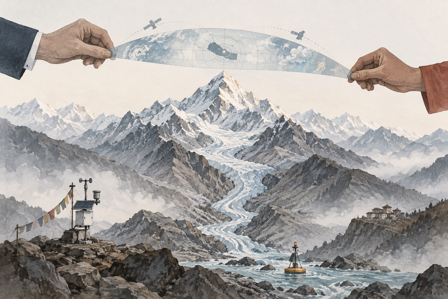
Himalayan Climate Resilience Mechanism
A proposed Nepal-led platform with India and China to share data, monitor glacier-related risks, improve early warning and coordinate disaster response.
Glacial-lake monitoring
Tracking lakes formed by melting glaciers that can suddenly burst or overflow, creating destructive downstream floods.
Early-warning system
A chain of sensors, forecasts, communications and local response protocols designed to alert communities before a hazard arrives.
Data sensitivities
Concerns that satellite, hydrological or border-area information used for disaster risk may also reveal strategically important details.
The Kathmandu Post
news
Balendra Shah UN speech: Full transcript of Nepal prime minister’s address to the 81st UN General Assembly
Public Service Broadcasting, Radio Nepal
news
PM Shah proposes tri-national ‘Himalayan climate-resilience mechanism’
Akashvani News / News On AIR
news
Nepal PM proposes Himalayan Climate Resilience Mechanism with India
Untracked bias
Bias and factuality ratings from Media Bias Fact Check. Outlets without a rating are marked “Untracked.”
Tri-national plan
Nepal proposed a Himalayan Climate Resilience Mechanism led by Nepal, India and China.
Data focus
The mechanism would share satellite data, monitor glacial lakes, strengthen early warning and coordinate disaster response.
Diplomatic test
The proposal tests whether India and China can cooperate operationally in the Himalayas despite strategic sensitivities.
Nepal’s Prime Minister Balendra Shah has proposed a Himalayan Climate Resilience Mechanism led by Nepal, India and China, aiming to turn the region’s shared exposure to floods, glacier collapse and landslides into a practical platform for data-sharing, early warning and cross-border disaster response.1
The proposal, made during Shah’s address to the 81st United Nations General Assembly, would focus on sharing satellite data and scientific expertise, monitoring dangerous glacial lakes, strengthening joint early-warning systems and coordinating assistance when disasters cross borders.16 Nepal’s public broadcaster described it as a tri-national mechanism intended to make the Himalayas a “laboratory” for cooperation rather than a zone of fragmented information.2
For South Asian diplomacy, the initiative is more than a climate appeal. It is an operational test of whether India and China can move from broad summit language on engagement to a limited, high-stakes risk platform in the Himalayas, where scientific data, river systems, border infrastructure and security sensitivities overlap.
Shah framed the proposal around the August 26 disaster near the Nepal-China border, when flash floods triggered by an ice-rock or glacial collapse devastated communities in northern and central Nepal and sent floodwaters downstream toward India.37 Indian public broadcaster Akashvani reported that the disaster killed 1,452 people, with 4,700 to 6,000 still missing.3 Al Jazeera, citing Nepal’s disaster authority, reported at least 1,453 deaths, 5,500 missing and 13,795 people rescued.5
In his UN speech, Shah said the flood had caused damage on both sides of the Nepal-China border and continued downstream toward India, arguing that climate risks do not stop at political frontiers.18 He said Nepal now faces recovery needs equal to about 10 percent of gross domestic product, while contributing less than 0.1 percent of global greenhouse-gas emissions.18
The timing gives the proposal urgency. The South China Morning Post, carrying Bloomberg reporting, said the initiative follows gaps in data-sharing that left mountain communities with virtually no early warning before the August disaster.4 That gap is central to Shah’s diplomatic challenge: the mechanism would require the three countries to share information that could save lives, but may also be considered strategically sensitive.
Nepal can monitor its own rivers, slopes and glacial lakes, but many Himalayan hazards form across borders or cascade through them. The Bhotekoshi-Trishuli disaster, according to Shah’s account, showed that a collapse near the Nepal-China frontier can devastate Nepali districts and then carry flood risk into India.17
That geography makes India and China indispensable to any serious Himalayan platform. Satellite imagery, upstream hydrological readings, glacial-lake assessments, landslide monitoring and rapid alerts all become more useful when they are shared early, standardized and trusted by downstream authorities.
The proposed mechanism would also have to translate science into response. Shah called for cross-border assistance coordination when disaster strikes, not just technical monitoring.1 Anadolu Agency reported that the operational agenda includes satellite data, scientific expertise, glacial-lake monitoring, cross-border early warning and disaster assistance.6
For New Delhi, the proposal touches directly on downstream flood risk, hydropower security and border-state disaster preparedness. Akashvani’s coverage highlighted the Nepal-India-China leadership format, satellite and early-warning cooperation, and the fact that floodwaters moved downstream into India.3 For Beijing, the plan would involve hazards emerging near or across the Nepal-Tibet border, where information-sharing could become politically sensitive even if framed as disaster prevention.
The mechanism’s logic is practical, but its politics are difficult. India and China have maintained diplomatic channels, but Himalayan cooperation remains constrained by mistrust, unresolved border tensions and sensitivities over mapping, satellite data, infrastructure and movement near contested or militarized areas.
A narrowly designed disaster-risk platform may be more feasible than a broad environmental accord. It could begin with low-risk exchanges: agreed terminology for alerts, shared thresholds for flood warnings, liaison officers during monsoon and winter hazard seasons, and time-bound sharing of imagery or hydrological readings after specific triggers.
Even limited cooperation would require answers to basic questions. Who would host the data? Would raw satellite imagery be shared, or only processed risk products? Would China and India accept a Nepal-led secretariat? Would local authorities receive alerts directly, or only through national capitals? Would the mechanism include real-time warnings, or slower scientific assessments after disasters?
The answers will determine whether Shah’s plan becomes a diplomatic statement or an operational system. A mechanism that produces annual meetings but not timely alerts would do little for exposed communities. A system that shares actionable data before a flood or glacial-lake outburst could become a rare area of India-China cooperation with immediate human-security benefits.
Shah’s proposal also reflects Nepal’s effort to use climate vulnerability as diplomatic leverage. By placing Nepal between India and China in the leadership structure, he cast Kathmandu not as a passive victim of upstream and downstream risk, but as a convening state for Himalayan resilience.26
That positioning is consistent with the broader message of his UN address. UN News coverage republished by Global Issues said Shah linked the disaster to climate justice, arguing that Nepal faces repeated damage to infrastructure and livelihoods despite contributing a tiny share of global emissions.8 He also called for more grant-based climate finance, saying existing mechanisms such as the Loss and Damage Fund and Global Environment Facility remain inadequate.8
The diplomatic pitch is therefore two-layered. Internationally, Nepal is asking wealthy countries to finance resilience and reconstruction. Regionally, it is asking its two largest neighbors to treat Himalayan risk as a shared security and development problem rather than a collection of separate national datasets.
The first sign of traction would be whether India and China publicly acknowledge the mechanism beyond routine expressions of sympathy or climate concern. A stronger signal would be the creation of a technical working group involving disaster-management agencies, meteorological departments, space agencies and foreign ministries from all three countries.
The most meaningful step would be agreement on a pilot corridor. Nepal could seek a focused system for one high-risk river basin or cluster of glacial lakes, with pre-agreed data formats and alert protocols. That would avoid the burden of negotiating a comprehensive Himalayan treaty at the outset while testing whether sensitive data can be shared for humanitarian purposes.
The August flood has made the cost of inaction visible. Shah’s proposal now asks whether the region’s most powerful states can separate disaster-risk cooperation from strategic rivalry long enough to build a warning system that works before the next Himalayan collapse.





Comments